- Course No E – 1619
- PDH Units 3.00
No data found for Custom Course Number
No data found for Custom Course Units
- Course No E – 1619
- PDH Units 3.00
Intended Audience: civil engineers and professional land surveyors
PDH UNITS: 3
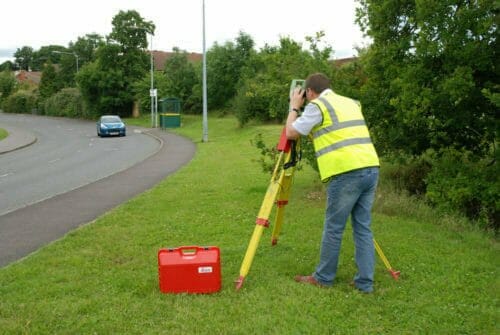
Gain a better understanding of horizontal control land survey methods and techniques. This course discusses horizontal control surveys that are performed to establish a monumented reference system for a facility mapping project. These fixed horizontal control points and vertical benchmarks are then used as starting points for supplemental topographic site plan mapping. Horizontal positions of permanent monuments around a facility or project site can be established by a number of survey techniques, including traditional traverse, triangulation, or trilateration surveys from an established geodetic network on an installation or region (e.g., NSRS). Alternatively, GPS methods can be performed to extend control from an established network to the project site. Since most modern day survey crews or firms possess both GPS and total station equipment, there would be little justification for running lengthy (and costly) traverses or triangulation/trilateration networks to bring control to a local site. Therefore, the course material will focus on current practices for performing "traditional" horizontal control surveys in which control is established using total station traverse methods. Triangulation and trilateration methods are briefly touched upon.
Course Outline
1. INTRODUCTION 2. TRADITIONAL HORIZONTAL CONTROL SURVEY TECHNIQUES 3. SECONDARY OR TEMPORARY HORIZONTAL CONTROL 4. BEARING AND AZIMUTH DETERMINATION 5. ELECTRONIC DISTANCE MEASUREMENT 6. COORDINATE COMPUTATIONS 7. TRAVERSE SURVEYS 8. TRAVERSE SURVEY GUIDELINES 9. TRAVERSE COMPUTATIONS AND ADJUSTMENTS 10. TRAVERSE ADJUSTMENT (COMPASS RULE) 11. TRIANGULATION AND TRILATERATION SURVEYSLearning Objectives
At the successful conclusion of this course, you’ll be able to identify and discuss:- Horizontal control survey methods
- Minimum instrument requirements for the establishment of primary control
- When primary project horizontal control points not permanently monumented in accordance with appropriate criteria and guidance should meet certain minimum standards
- When to use redundancy techniques
- Repeating and directional theodolites
- Importance of station calibration
Once completed, your order and certificate of completion will be available in your profile when you’re logged in to the site.


